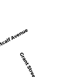
19 METCALF AV
Owner Information
MONTOYA ANTHONY F
19 METCALF AVE
MILFORD, MA 01757


Property Details
19 METCALF AV is classified as a Single Family Residential (Split ent).
The primary structure on this property was built in 1962. There are 1,858ft2 of built area within this property. There is 1,858ft2 of residential/living space within this property. This property is listed as having 5 rooms.
19 METCALF AV is valued at $341,200. The land is valued at $138,400 and the structures are valued at $201,500. There is an additional valuation of $1,300 on this property.
This property is in Zone RA. Confirm with local Zoning Board authorities to ensure there are no overlays or other easements on this property.
The most recent deed for 19 METCALF AV is recorded at the local registrar in Book 56591, Page 222. 19 METCALF AV was last sold on Tuesday, January 10, 2017 for $100.
Assessment data from fiscal year 2022.
Flood Data
According to the FEMA National Flood Hazard Layer, this property does not appear to be in a flood zone. It may also be in an area not yet reviewed. Nonetheless, confirm this information prior to taking any action.
To view the flood hazards around this property, create a FEMA "Firmette" Map of the area around 19 METCALF AV.
Broadband Internet Providers
| Provider | Type | Bandwidth (mbps) | |
|---|---|---|---|
| Viasat Inc | Satellite | 100 | 3 |
| HughesNet | Satellite | 25 | 3 |
| T-Mobile | Fixed Wireless | 25 | 3 |
| GCI Communication Corp. | Satellite | 0 | 0 |
| VSAT Systems, LLC. | Satellite | 2 | 1 |
| Comcast | Cable | 1000 | 35 |
| Verizon New England Inc. | Fiber | 940 | 880 |
| Verizon New England Inc. | DSL | 15 | 1 |
Broadband service provider data from December 2020.
Adjacent Properties
- 49 GRANT ST
Single Family Residential owned by DEHNER DEBRA A - 47 GRANT ST
Single Family Residential owned by ESCOBAR RIVERA MARIBEL - 50 PURCHASE ST
Single Family Residential owned by MILANI DONALD D - LE - 21 METCALF AV
Single Family Residential owned by HENDRON CHRISTOPHER L - 51 GRANT ST
Single Family Residential owned by CHEKHUTA YAROSLAV